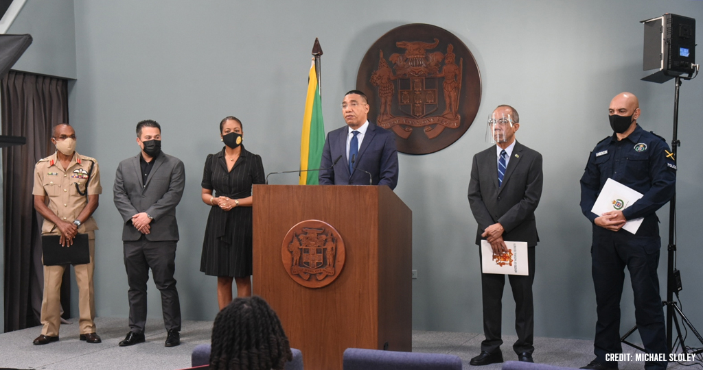
Jamaica declares “State of Public Emergency” in Seven Police Divisions
Jamaica Prime Minister Andrew Holness declares State of Public Emergency (SOEs) in seven police divisions islandwide to curtail upsurges in violent crimes.
Holness made the announcement on Sunday (November 14), indicating that SOEs have been declared in St. Andrew South, Kingston West, Kingston Central, and Kingston East in the Corporate Area, and St. James, Hanover, and Westmoreland.
The decision was brought about by the increase in the record of violent crimes, ranging from 16 to 57 per cent.
“We have decided to recommend the declaration of SOEs having regard to the increase in murders, compared year on year, both in the communities in which we have declared them and nationally. These increases we consider to be of an extensive scale such that they threaten public safety, both in the communities in which the SOEs have been declared and nationally.”
Holness stated that the murder rates in these divisions range from a low of approximately 47 per 100,000 to a high of 190 per 100,000.
“SOEs have also been declared because of the nature and frequency of violence surrounding the murders and other crimes, which has evolved to a level of barbarity, [and] a level of savagery, [such that] it is almost [like] a competition for cruelty.”
In addition, Police Commissioner Antony Anderson said the imposition of the states of public emergency is designed to reduce violence in the communities as quickly as possible and reduce fear.
“As of Friday (November 12), there were 1,240 victims of murder, 392 of those were killed across the four divisions in Kingston and St. Andrew which represent 32 per cent of the national figure. Of the 1,100 persons shot but who were not killed, that region accounted for 391 of the victims or 36 per cent of the national figure. In the parishes of St. James, Westmoreland and Hanover, there have been 272 victims of murder which represent 22 per cent of the national figure, while 214 were shot and injured, also representing 22 per cent of the national figure.”
General Anderson noted that other security measures will continue across the island.
Meanwhile, Chief of Defence Staff (CDS) Rocky Meade said the spike in violent crimes has proven to be well beyond the sphere of normal routine policing.
He likewise encouraged citizens to provide information that can assist the security forces by calling 311 or 876-837-8888.
Jamaica’s homicide rate remains within the top five countries in the world.
Boundaries of the State of Public Emergency in corporate area/s
NORTH: The northern boundary will start at the westernmost end of the Belvedere to Ferry secondary road, extending in an easterly direction along the Belvedere to Ferry Road and then continue easterly to the foot of Red Hills, at the intersection of Perkins Boulevard, Molynes Road and Red Hills Road. The boundary then continues in a south-southeasterly direction along Molynes Road, Seaward Drive, Mimosa Road, Aloe Avenue, Bay Farm Road, Newark Avenue, Elm Crescent, Keesing Avenue, Hagley Park Road, Omara Road and Chisholm Avenue; then onto Maxfield Avenue, Rousseau Road and in an easterly direction to Lyndhurst Road to its intersection with Slipe Road, then easterly along Torrington Road to Heroes Circle and then continues to Connolly Avenue, onto Dames Drive to the intersection with South Camp Road; the boundary then proceeds onto Vineyard Road, Diana Drive to Lexington Avenue and then onto Deanery Road to the intersection with Mountain View Avenue; the boundary then extends in an easterly along an imaginary line to the shared parish border of St Andrew and St Thomas.
EAST: The eastern boundary continues in a southerly direction along the shared parish border of St Andrew and St Thomas to the coast.
SOUTH: The southern boundary extends westerly along the coast of St Andrew, then along the Kingston coastline to the Kingston Container Terminal and then to the Portmore Causeway Bridge.
WEST: The western boundary continues in a north-westerly direction from the Portmore Causeway Bridge along the Fresh River, then along the shared parish border of St Andrew and St Catherine, west of Riverton, and extends to intersect with the northern boundary at the westernmost end of the Belvedere to Ferry secondary road.
SOE for St James, Westmoreland and Hanover
NORTH: The northern boundary starts from Lucea in Hanover and then extends in an easterly direction along the coast of Hanover and then St James to the coastal intersection of St James and Trelawny parish boundaries.
EAST: The eastern boundary then extends in a southerly direction along the shared parish borders of St James, Trelawny, St Elizabeth and Westmoreland to the coast.
SOUTH: The southern boundary continues along the coast of Westmoreland to the westernmost point of the island at West End in Westmoreland.
WEST: The western boundary then extends in a northerly direction along the coast of Westmoreland and then Hanover to the coast at Lucea in Hanover.


