


Magnitude 6.1 earthquake hits Sumatra island
According to the country’s geophysics agency, a magnitude 6.1 earthquake struck off the coast of Indonesia’s Sumatra island.
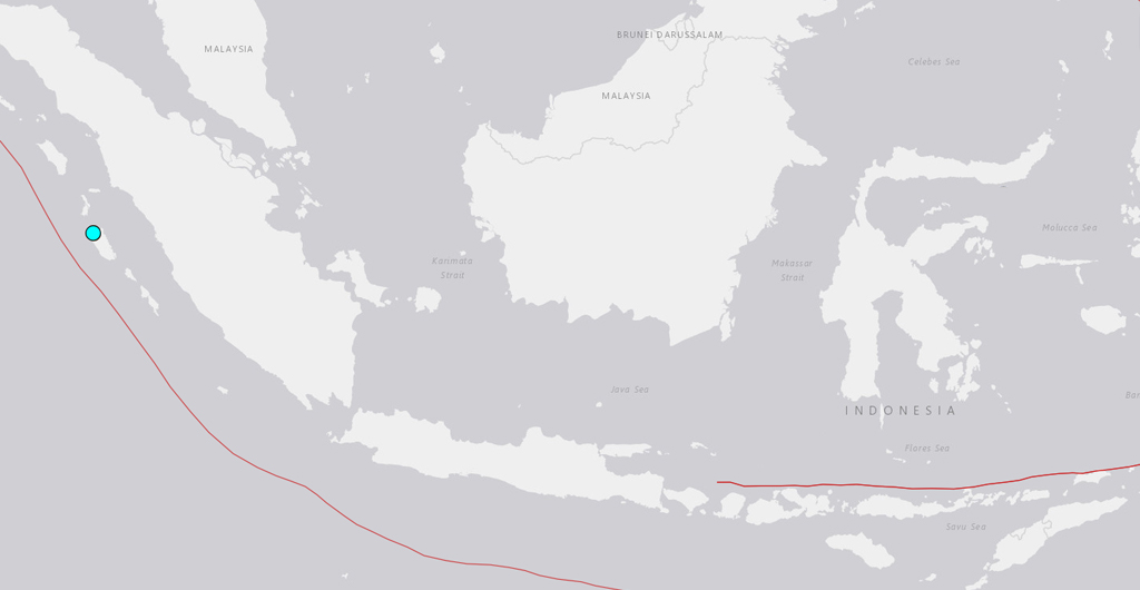
Just before 10:30 am, the shallow earthquake off the Mentawai islands, off the west coast of Sumatra, was detected by Indonesia’s meteorology and geophysics agency (BMKG), which reported that it did not cause a tsunami warning.
According to a BMKG official, the agency originally reported a magnitude of 6.4 but then reduced it to 6.1.
Since the early hours of Monday, three earthquakes have occurred in quick succession, each becoming more powerful. A magnitude 5.2 earthquake occurred before daybreak, and a magnitude 5.4 earthquake was registered less than an hour later.
Residents of the Mentawai islands, the province capital of Padang, and the neighbouring hilly region of Bukitinggi all reported feeling the earthquake strongly for many seconds, according to a statement from the disaster service.
On Siberut island, there was minimal structure damage, according to the agency, but no reports of injuries.
Novriadi, a Mentawai disaster administrator, told Reuters that people had been evacuated from numerous villages to higher ground and that a nearby church, school, and medical centre had suffered minor damage. The disaster agency called to calm down and warned about possible aftershocks.
Indonesia lies in the so-called “Pacific Ring of Fire,” where various tectonic plates of the Earth’s crust collide, causing regular seismic activity.