Tropical Storm Paulette approaches Bermuda
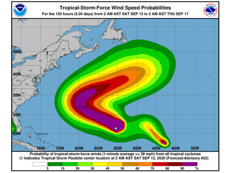
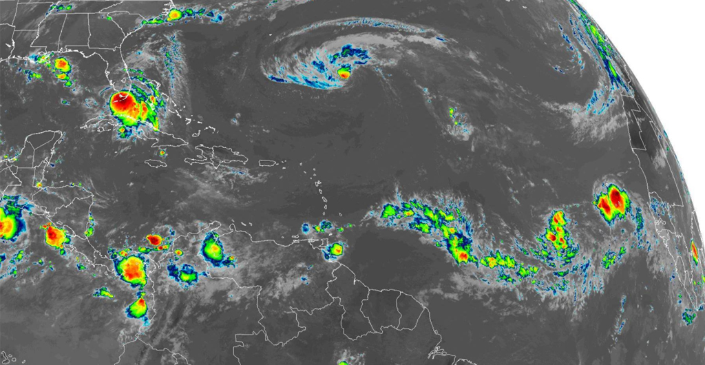
Tropical Storm Paulette is moving northwestward over the central Atlantic and is expected to become a hurricane today and possibly bring hazardous conditions to Bermuda by tomorrow night.
According to the latest Public Advisory issued by the National Hurricane Centre, Paulette is about 590 miles southeast of Bermuda moving at 16 miles per hour with maximum sustained winds of 70 miles per hour with higher gusts. Tropical-storm-force winds extend outward up to 205 miles (335 km) from the centre
The centre of Paulette is forecast to move near Bermuda Sunday night and Monday.

With the current forecast, the Bermuda Weather Service has issued a Tropical Storm Warning and a Hurricane Watch for the island.
A Tropical Storm Warning means that tropical storm conditions are expected somewhere within the warning area within 36 hours.
A Hurricane Watch is also in effect because of the possible hurricane conditions that may affect the area. It is typically issued 48 hours before the anticipated first occurrence of tropical-storm-force winds, conditions that make outside preparations difficult or dangerous.
Paulette may bring periods of heavy rain to Bermuda through Monday, with rainfall accumulations of 2 to 4 inches, with maximum amounts of 6 inches possible.
Moreso swells generated by Paulette are affecting portions of the Leeward Islands and will continue to spread westward to portions of the Greater Antilles, Bahamas, Bermuda, and the southeastern United States this weekend. These swells are likely to cause life-threatening surf and rip current conditions.
“Extremely Active” Hurricane Season
The National Oceanic and Atmospheric Administration (NOAA) has said last month that the rest of the hurricane season will be “extremely active”.
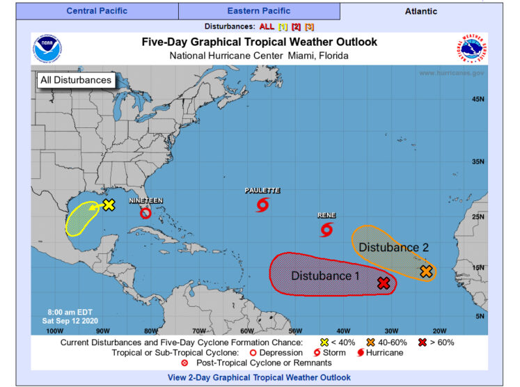
Apart from Tropical storms Paulette and Rene, NHC is monitoring for at least two more disturbances over the Atlantic that may develop in the next five days.
A broad area of low pressure located several hundred miles southwest of the Cabo Verde Islands is producing a large area of disorganized showers and thunderstorms. Development of this system is forecast, and a tropical depression is expected to form within the next couple of days while the system moves generally westward at 15 to 20 mph across the eastern and central tropical Atlantic.
Another area of disturbed weather, associated with a tropical wave, is located near the Cabo Verde Islands. Environmental conditions support some development during the next few days, and a tropical depression could form over the far eastern tropical Atlantic early next week while the system moves slowly westward. By mid-week, upper-level winds could become less conducive for development.


